
Thermal Imaging Drones: Revolutionizing Disaster Relief Operations
Alabama, USA, recently faced a devastating tornado, where thermal imaging drones played a crucial role in post-disaster rescue operations.
Public safety agencies worldwide, including search and rescue teams and firefighting units, are increasingly utilizing thermal imaging drones in critical situations like natural disasters.
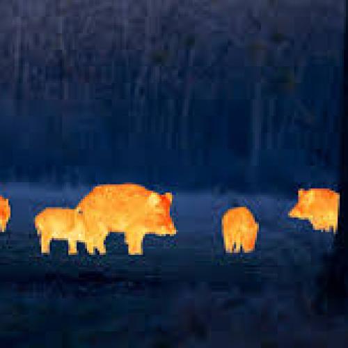
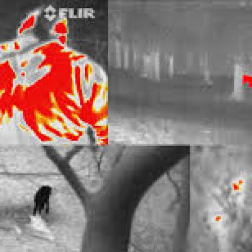
Lee County, Alabama, was hit by a tornado. Reports indicate that the tornado, described as "monster-sized," ripped through miles of land, uprooting homes and trees. The powerful winds even carried a billboard 20 miles away. This catastrophe resulted in at least 23 fatalities. Rescuers deployed a potent tool in their relief efforts — thermal imaging drones. These drones, equipped with infrared cameras, can detect heat sources on the ground, buildings, or water 24/7, whether they're human or animal, alive or deceased, or other heat-emitting objects like flames. The devices transmit color-coded images in real-time to laptops, phones, tablets, or large screens, highlighting heat sources in vivid colors like red, white, or others based on user settings.
"Drones give us a bird's-eye view, allowing us to see areas we might miss if we were on the ground at eye level," said Jones. Rescue workers and firefighters who have used this technology consider thermal imaging drones as effective tools for saving lives. Drones are cheaper than manned aircraft like helicopters and are more maneuverable in confined spaces, requiring less training for operation.
Rapid Person Detection
Officials in Nepal and Mexico used drones equipped with thermal detection equipment after devastating earthquakes. In California's wildfire suppression efforts, firefighters used thermal imaging drones to map fire-ravaged areas and search for burned-down homes. Thermal imaging drones have also been used to locate missing persons, such as when a drone found an 11-year-old girl in dense forests in North Carolina last year.
Last summer, Sheriff Matt Dunn of Hamilton County, Tennessee, received an emergency call. A man involved in a domestic dispute had fled his home, venturing into the swampy forests near Chattanooga. Dunn rushed to the scene with a thermal imaging drone. He maneuvered the aircraft through thick tree canopies and located the target in about 6 minutes — a heat signature sitting under a tree. The man was swiftly and safely rescued. "It's a miraculous tool," Dunn said. "It's much faster than the time it would take for police and K-9 units to conduct a search."
Assisting in Disaster Relief
In the San Francisco area, the Menlo Park Fire District has a fleet of about 15 drones, each with varying capabilities, some equipped with regular cameras, while others have thermal imaging cameras. During last year's devastating wildfires in Northern California, thermal imaging drones mapped areas engulfed by flames. "These photos were sent to firefighters' phones to help them effectively fight the fires," said Fire Chief Harold Shapell-Horvitz.
Menlo Park firefighters also used thermal imaging drones to search for missing persons in the San Francisco Bay Area and sent drones to Texas to assist in the aftermath of Hurricane Harvey. Shapell-Horvitz said drones surveyed submerged areas, making it easier for rescue boats to navigate through fallen trees, power lines, and other obstacles. "It's an incredibly efficient tool," Shapell-Horvitz said. According to estimates, the US Department of Defense has spent $200,000 on thermal imaging drone projects, including pilot training costs.
Thwarting Thieves
In Polk County, Florida, Sheriff Grady Judd's airborne response team has 20 drone pilots. Polk County uses thermal imaging drones at night to search for thieves who believe they can safely commit crimes under the cover of darkness.
Drone operations in Florida are subject to strict laws. Judd said the sheriff's office can only use drones in emergencies, such as tornadoes or hurricanes, or when ordered by a court. "Drones cannot be used for traffic monitoring or even crowd surveillance at football games," Judd said.
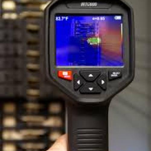
The FLIR Systems company, based in Portland, Oregon, designs, manufactures, and sells thermal imaging cameras for use by police and fire departments. Frank, the company's Senior Vice President of Global Product Strategy, said the company began venturing into drone camera business for public safety agencies about four years ago. According to Frank, depending on performance differences, the combined prices of these cameras and drones range from $1,500 to $10,000. A study report released by the Bard College Drone Center in May last year stated that at least 910 state and local police, sheriff, fire, and emergency service agencies in the United States have purchased drones. The report states that it is currently unclear how many agencies have thermal imaging-capable drones, estimated to be less than 25%, but the number is likely increasing.
Contact: Mr.Tom
Phone: 0086-755-85279352
E-mail: sales@szjeavox.com
Add: FL7-8,4 Bldg,Honghui Industrial Park,Liuxian 3 Rd,68 Zone,Bao'an,Shenzhen, China
 Mr.David